

 “Ring of Fire” Thunderstorms and “Heat Dome” Scorch many parts of the U.S. early in the Summer Season
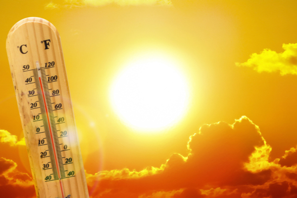
A major heat wave has built and taken center stage in the weather late last week and into this next week. AccuWeather meteorologists advised that groups of severe thunderstorms would erupt on the edge of the “heat dome” of hot air. The storms will take on a “ring of fire” effect, erupting first over parts of the northern Plains and Midwest, followed by portions of the Northeast and finally the Southwest and central Plains.
What is a Heat Dome?
A heat dome is a weather phenomenon where high-pressure atmospheric conditions create a “lid” over a region, trapping heat and causing temps to rise significantly. It’s essentially a large, slow-moving area of high pressure that traps warm air, preventing it from rising and dissipating. This trapped air then gets compressed and heated further, leading to intense and prolonged heat.
The intense high pressure and sinking air within a heat dome make it difficult for thunderstorms to form in large numbers. However, thunderstorms tend to erupt on the edges of the heat dome, as the high pressure area is weakest in these areas, allowing columns of air to rise and form towering clouds and gusty downpours.
In late June 2021, a heat dome parked over the West Coast states led to record-shattering temperatures. Seattle hit the 100-degree mark on three consecutive days, peaking at 108 on June 28. It was even hotter in Portland, where the mercury jumped to 116 degrees, melting away the previous all-time record high temperature of 107 set in the city in 1981.
What are Ring of Fire Thunderstorms?
According to AccuWeather, heat domes can act like large, unmovable bubbles, forcing any moisture to move up and over the bubble of heat. Thunderstorms that ignite on the fringe of the heat dome are known as ring of fire thunderstorms.
“You hear the ‘ring of fire’ when we talk about volcanoes in the Pacific,” AccuWeather Chef On-Air Meteorologist Bernie Rayno explained. “In the world of meteorology, the ring of fire deals with thunderstorms along the northern edges of strong upper-levels high. Oftentimes, this setup produces severe thunderstorms along the northern edges of the heat.”
Severe weather ramped up Friday night
On Friday, part of the same zone was affected by thunderstorms. As the heat dome expanded northward, it squeezed the zone of severe weather farther to the north.
Severe storms rolled through portions of the Dakotas and northern Minnesota, leading to widespread reports of damaging winds, and a few reports of hail and tornadoes. One storm produced a wind gust of 111 mph in south-central South Dakota.
Severe weather risk continued over the weekend
Additional rounds of thunderstorms, including severe weather, affected the northern edge of the heat dome along the United States/Canada border near the Great Lakes, expanding to New England as the weekend progressed.
Meteorologists warned that this could evolve into a long-lived damaging wind event, called a derecho, as it traveled from northern Minnesota to parts of Ontario and then into a portion of the Northeast. If this thunderstorm complex holds together as it moves over the Atlantic, conditions this coming week could support the gradual development of a tropical rainstorm between Bermuda and the Carolinas.
Plains storms to return this week
“Farther west, on the opposite side of the heat dome, tropical moisture–some associated with Erick–will be drawn across New Mexico, Colorado and parts of the High Plains next week,” Belscher said. “Where a channel of moisture persists in parts of the Southwest, it could help ease drought and wildfire concerns,” she added. This could be a great relief for those suffering from the New Mexico wildfires.
The core of the heat dome will tend to turn off the daily downpours and thunderstorms from much of the Midwest to the mid-Atlantic. However, as is often the case with the weather, there can be some exceptions. Severe thunderstorms will also erupt over portions of the Plains this coming week.
—
Photo Credit: Ed Connor / Shutterstock.com
 Melting Glaciers Could Cause More Volcanic Eruptions
 What’s Atlantic Niña, and How Could It Impact this Year’s Hurricane Season?
 Extreme Heat Wave Tripled the Number of Deaths in Europe this Summer
 Shark Week? Try Shark Summer.
 What’s the Best AC Temperature to Set during a Summer Heat Wave?
